
Walk an Elizabethtown Street
A sound street directory search moves from a full address to stable record keys. Start with the exact spelling and unit. Hardin County property records can supply the map ID, legal description, subdivision, owner label, sales references, and deed book and page. City and county maps then show whether the point and parcel agree. Only after that should a name or deed reference go into the Clerk index, which does not search by street address.
Keep the date, parcel ID, book and page, and role of each named person. That prevents two similar street labels from becoming one false match.
- Enter the full address through the Hardin County PVA route and save the parcel or map ID.
- Compare it with Hardin County GIS and city parcel layers.
- Use the owner, map ID, or book and page in the Clerk land index.
- Read the deed image and cited plat, restrictions, or later transfer.
- For an old household, find a dated directory and verify it in a contemporary source.
Elizabethtown Parcel Search Fields
The PVA bridges an address and the name-indexed land records. Its official description covers ownership, size, location, land use, assessed value, taxes, sales, parcel maps, zoning, and improvements. Live labels can change, so these are record fields and outputs, not a promise that each is a search filter.
| Field | Use | Limit |
|---|---|---|
| Owner and prior owner | Name key for deeds | Not occupant proof |
| Location or situs | Physical parcel reference | May differ from mailing address |
| Parcel number or Map ID | Bridge to map, tax, and Clerk tools | Copy exactly |
| Legal description | Lot, block, or tract identity | May omit street number |
| Sales and book/page | Title-history start | Verify the deed image |
| Assessment and improvements | Value and building context | Not sale price or occupancy |
If the web route fails, the PVA publishes a map-request form asking for owner, address, map number, and delivery details. Research recorded a $25 charge, but confirm it before payment. The office at 150 N. Provident Way, Suite 227, also takes questions by phone at 270-765-2129.
Elizabethtown Records by Address
No Elizabethtown street directory contains every person linked to a place. Each keeper contributes one dated part of the record.
| Record | Keeper | Contribution | Access |
|---|---|---|---|
| Parcel card | Hardin PVA | Owner, situs, mail address, map ID, deed keys | Online, office, map request |
| Parcel map | County and city GIS | Shape, streets, limits, zoning | Viewer or REST query |
| Deeds and plats | Hardin Clerk | Parties, dates, book/page, legal description | Online and archive |
| Delinquent tax | Hardin Clerk | Tax year, bill, grantor, map description | Public dynamic search |
| Permit | City Planning | Project address, type, inspection path | SmartGov or narrow request |
| Voter data | Kentucky elections | Controlled registration fields | Identity lookup or SBE-84 request |
When a portal has no result, contact the keeper with the exact address, parcel ID, record type, and date range. Library, society, and archive staff cover older sources that have no public index.
Map Elizabethtown Street Layers
The city GIS catalog exposes parcel boundaries, roads, right-of-way, zoning, city limits, cemetery markers, and geocoders. The parcel service supports identify and query operations. Hardin County GIS adds countywide context and warns that parcel lines can be skewed by coordinate-system limits. A deed, plat, or survey controls a legal boundary.
The assigned capture of the city parcel boundary service shows the source behind this part of the street directory.
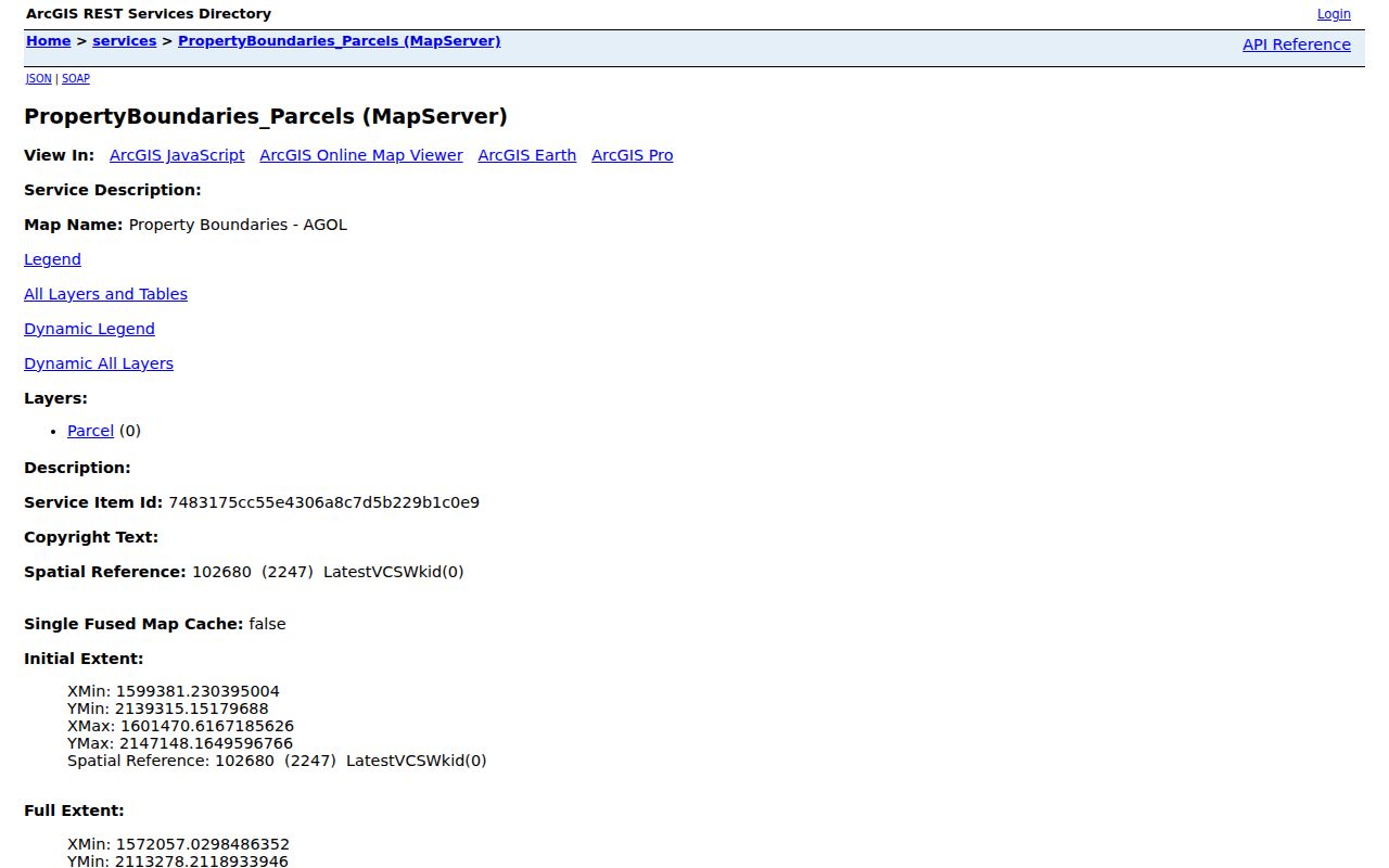
Its functions document map features, not the current occupants of a building.
Names Unlock Elizabethtown Deeds
The Clerk Quick Start states that land records are not indexed by address. Search by grantor or grantee, book and page, map ID, advanced fields, or file number. A grantor transfers an interest; a grantee receives it. The online deed index begins May 1, 1938, while archival deed books reach 1793. Mortgage online coverage begins June 17, 1964, and plats are indexed from 1793.
Restrictions, lis pendens, easements, plats, mortgages, and liens may use distinct routes. A missing image may reflect an online boundary, not an absent document.
- Parcel
- A mapped unit of land with a parcel or map number.
- Situs address
- The physical parcel location, which can differ from mailing address.
- Plat
- A recorded drawing of lots, blocks, streets, or tracts.
- Criss-cross directory
- A directory ordered by street and house number.
Elizabethtown Street Directory Tax Clues
The Hardin delinquent tax search exposes bill, grantor, map or legal-description, and amount fields. It can connect a tax row to the map ID used in parcel research. It cannot prove that a named party lives there.
The assigned manifest image records this official search route.
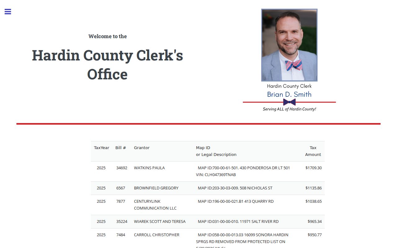
Match the bill and map details to the PVA and deed before joining a name to a household.
Elizabethtown Street Directory Plats
The Clerk archive preserves Elizabethtown plats from 1847 and 1868. Old deeds may name a lot, block, creek, railroad, or neighbor without a modern house number. Join the plat to the deed description, then test it against current GIS.
Research found no official local street-renumbering history. Do not push a modern number into the past without a dated source. A directory, deed, plat, and newspaper can each establish a separate point in time.
Note: A current map is a comparison tool, not proof that an old lot always carried today's street name or number.
Elizabethtown Street Directory Permits
The SmartGov portal handles construction, demolition, electrical, fire, sign, pool, temporary structure, and planning applications. A permit may tie an applicant or project to an address and show review or inspection steps. It does not prove residence.
Public reports and documents showed no items during research. Ask City Planning for a defined permit type, address, and date range through the city records route.
Elizabethtown Street Directory Address Layers
Official street addresses commonly use 42701, while some PO Box and administrative mail uses 42702. ZIP lines do not equal city limits. Confirm delivery through USPS, municipal position through city GIS, and parcel location through PVA or county GIS.
A unit, shared mailbox, condominium, or multi-parcel site can create more than one valid key. Keep ZIP, parcel, unit, and project address distinct. For dated household sources, continue with the Elizabethtown city directory collections.
Elizabethtown Street Directory Voter Clues
Kentucky's Voter Information Center is an individual current-registration and polling-place check, not an open list of everyone along an Elizabethtown street. It asks for legal first name, last name, date of birth, and optionally the last four digits of a Social Security number. Those identity fields make it useful for a person who checks a known registration, but they do not support a public walk down a block.
A broader voter-data route uses the SBE-84 request form. Research documents requester and purpose fields, geographic selection, output format, payment controls, and a noncommercial-use oath. Released data may include name, residence and mailing fields, precinct, ZIP, party, status, registration date, and voting-history fields. Access is controlled and purpose-bound. Never treat party, voting history, or a dated registration address as proof that someone occupies a property today.
For a street directory question, use voter material only after the parcel and address have been resolved, keep the list date, and preserve any protected-address limit. County election staff can explain current request procedures when the online individual lookup is not the right channel.
Elizabethtown Street Directory Archive Route
Historic address work often begins where the online portal ends. The Hardin County Clerk's Quick Start identifies deed books A through Z and 1 through 99 before the May 1938 online boundary, along with older mortgage books, settlement books, election records, and FamilySearch probate or court-order routes. The Clerk archive also supplies historic plats and pre-1988 restriction material. Take the modern map ID, legal description, deed book and page, and every spelling variant to the archive.
Hardin County Public Library, the Hardin County Historical Society, the History Museum, and the Ancestral Trails research library provide the next access channels. Their catalogs and staff may locate telephone books, a reverse directory, cemetery lists, school or church records, local articles, or family histories. Exact reverse-directory years were not published online, so ask for a specific year and street rather than claiming a complete run.
KDLA is the state fallback for older county holdings and requests. It notes that a records request may take four to six weeks and that not every source is indexed or digitized. A useful request identifies record type, approximate date, party name, book or page when known, and the exact copy or lookup sought.
Elizabethtown Street Directory Fraud Signals
A July 7, 2025 Hardin County notice warned residents about property and mortgage fraud. That timely local alert gives address research a practical use: compare an unexpected deed, mortgage, lien, assignment, release, or lis pendens with the established owner and parcel keys. The public notice did not expose a verified signup field set during research, so do not promise an alert enrollment path that the source did not show.
Start with the PVA card and save its map ID and deed reference. Then search the Clerk's correct instrument route and read the recorded image. Check party roles, filing date, book and page, legal description, referenced plat, and any release or assignment. A similar name, tax row, or index result is only a prompt to inspect the source. It is not evidence of wrongdoing.
The Clerk at 150 N. Provident Way, Suite 103, and the PVA in Suite 227 are the direct office fallbacks. Ask the Clerk about the recorded instrument and the PVA about the assessment record. Keep screenshots and access dates because live portal rows and certified coverage dates change.
Elizabethtown Street Directory Source Log
Every address result should carry a small source log. Record the portal or office, access date, street spelling, unit, parcel or map ID, legal description, book and page, and the role attached to each name. Save a stable image or citation when the keeper permits it. Dynamic property, tax, permit, and voter results can change, while an archival book may use an older index rule.
Conflicts are normal. A USPS delivery point, PVA situs, owner's mailing address, permit project address, plat lot, and deed description may refer to one place in different ways. Resolve them through dates and record keys. Do not silently choose the label that fits an expected answer.
A source log also makes an office request precise. Staff can respond more effectively when given the known parcel, instrument, year, and desired record instead of an open-ended request for every person connected to an Elizabethtown address.
Elizabethtown Street Directory Limits
Ownership, map, tax, permit, and deed sources do not list everyone at an address. Owners may live elsewhere, and an estate or trust may hold title. The voter lookup requires personal identity fields and is not a public street roster. Safe at Home can substitute a public mailing address while protecting a survivor's physical location.
A street directory result should retain its source date and role. Use the PVA office, Clerk archive, city request channel, HCPL reference desk, HCHS, Ancestral Trails, FamilySearch, or KDLA when an online route fails.
Lawful use. Use Elizabethtown address records for lawful personal research. Never use a map, roll, substitute address, or record trail to stalk, harass, intimidate, or expose someone.